Products
PetroTrace has many years of experience in processing and interpreting seismic data, which allows it to create its own developments that accelerate the work and improve the quality of seismic images. Today the company has its own software development department with high-class programmers, who in tandem with geophysicists and geologists create domestic solutions.
iNSTA-Geo
Batch processing of seismic data
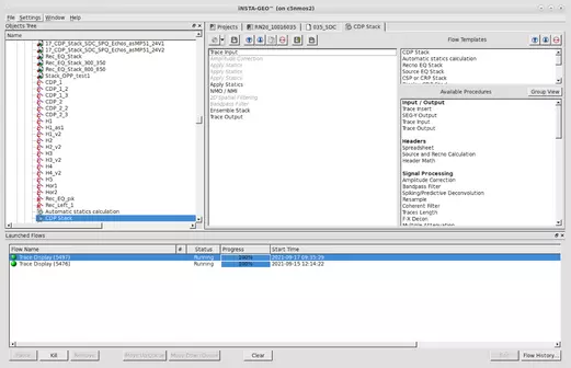
Main program window. Within the iNSTA-GEO software system, the functionality of generating complete seismic data processing tasks is implemented.
Interactive static corrections
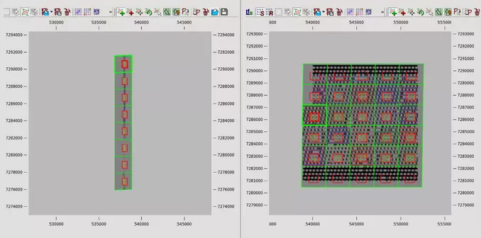
Example of an interface for working with patterns for partial summation.
Upper part of the section model construction on first breaks
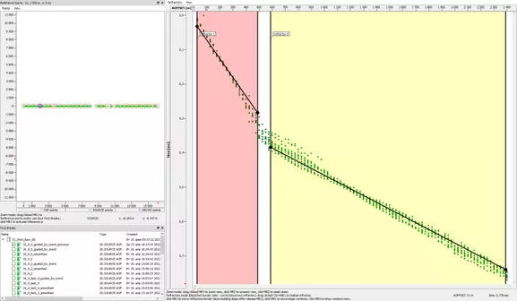
Creating a refractor model in Time Offset Scatter.
- Quality control tools
The iNSTA-GEO software product also has a unique functionality to control the quality of shooting surveys for 4D processing and interpretation. It is based on the evaluation of the positioning of receiver-source pairs and the subsequent calculation of NRMS attributes, which clearly demonstrate the deviation of the surveys from each other.
- Integration with other processing systems
The iNSTA-GEO software package enables integration with third-party processing systems for collecting, storing, and processing seismic data. The availability of software development and support teams makes it possible to provide customers with this service.
- Minimum software requirements
The information about the minimum and recommended configuration of the computer is given below:
Supported operating systems:
Windows 7, 8, 10
Linux family of operating systems using kernel version 2.6.32-x86_64
Minimum configuration:
- Intel Core I3 3GHz processor or AMD Athlon 5150
- 4GB RAM
- NVidia Geforce 5200 graphics card 128 MB video memory
- Disk memory - HDD 300 MB for program storage and 21 MB at each starting database (without the memory for geophysical datasets).
Recommended configuration:
- Intel Core I7 3 GHz or higher processor or AMD Ryzen 7 5700G
- 32 GBytes of RAM and higher
- NVidia GeForce 6600 graphics card with 256 MB of video memory or more
- Disk memory - SSD 300 MB for program storage and 21 MB for
for each initial database (without geophysical datasets).
- Contacts and information
If you have any questions about purchasing the software or trying it out, please contact the following e-mail addresses:
Alexander.Sibirtsev@ptgeos.com
- Information needed to install and operate the software
In the attached file you can find all the necessary information for installing and operating the software.
Important: In all scenarios of using the software it is necessary to have a HASP hardware security key.
Modules for Emerson ECHOS software
Software modules from the «Filtering» category
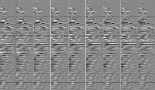
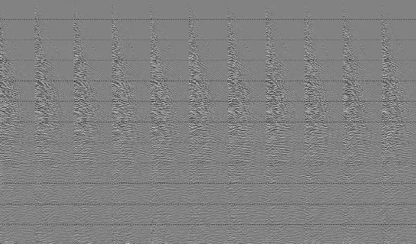
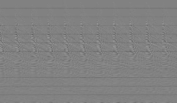
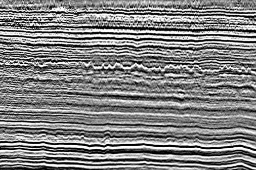
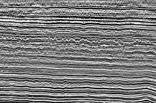
Example of CMP seismograms before (left) and after (right) multiple wave subtraction with the MSPAR module.
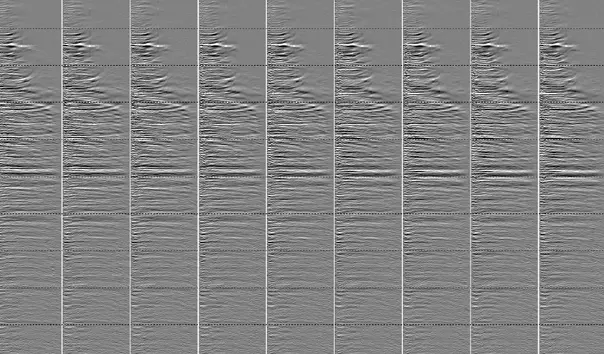
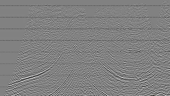
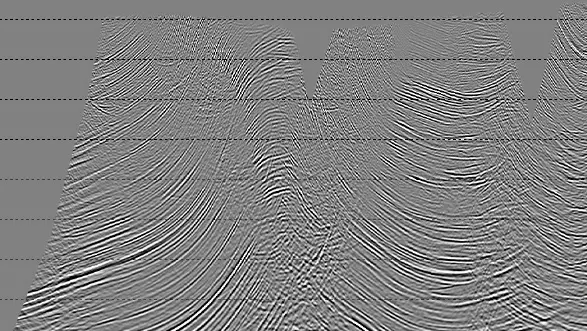
Example of CMP seismograms before (left) and after (right) phase correction with GFLAT.
Software modules from the «Signal extraction» category
Example of CMP seismograms before (left) and after (right) multiple wave subtraction with the MSPAR module.
Example of CMP seismograms before (left) and after (right) phase correction with GFLAT.
Software modules from the «Signal extraction» category
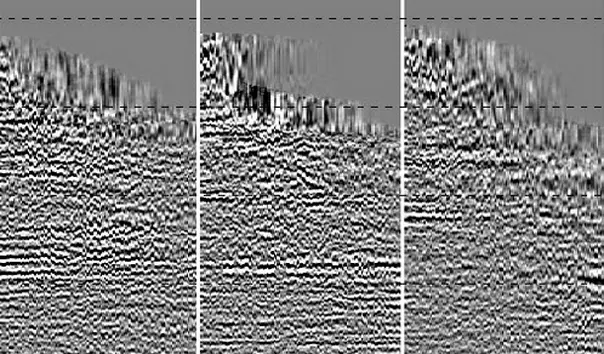
Example of CDP seismograms before (left) and after (right) multiple wave subtraction with the MSPAR module.
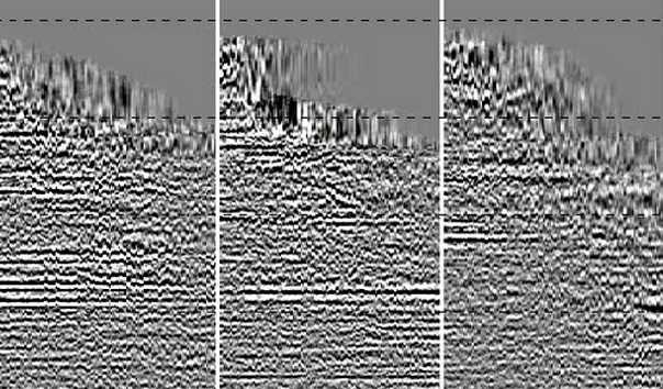
Example of CMP seismograms before (left) and after (right) phase correction with GFLAT.